Boulder Lake Hike
(text and photos by Glen Kirkendall)
Boulder Lake coordinates: 30.39.304’N, 106.36.254W 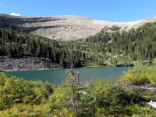
- Travel to Ohio City on Colorado 76, and take the Gold Creek Road, Colorado Road 771.
- Follow CR771 north to the Gold Creek Campground parking area which is 6.80 miles north of Ohio City. 10,030’ elevation.
- Park your vehicle in a manner that permits thru traffic to pass up the two wheel trail that continues beyond there.
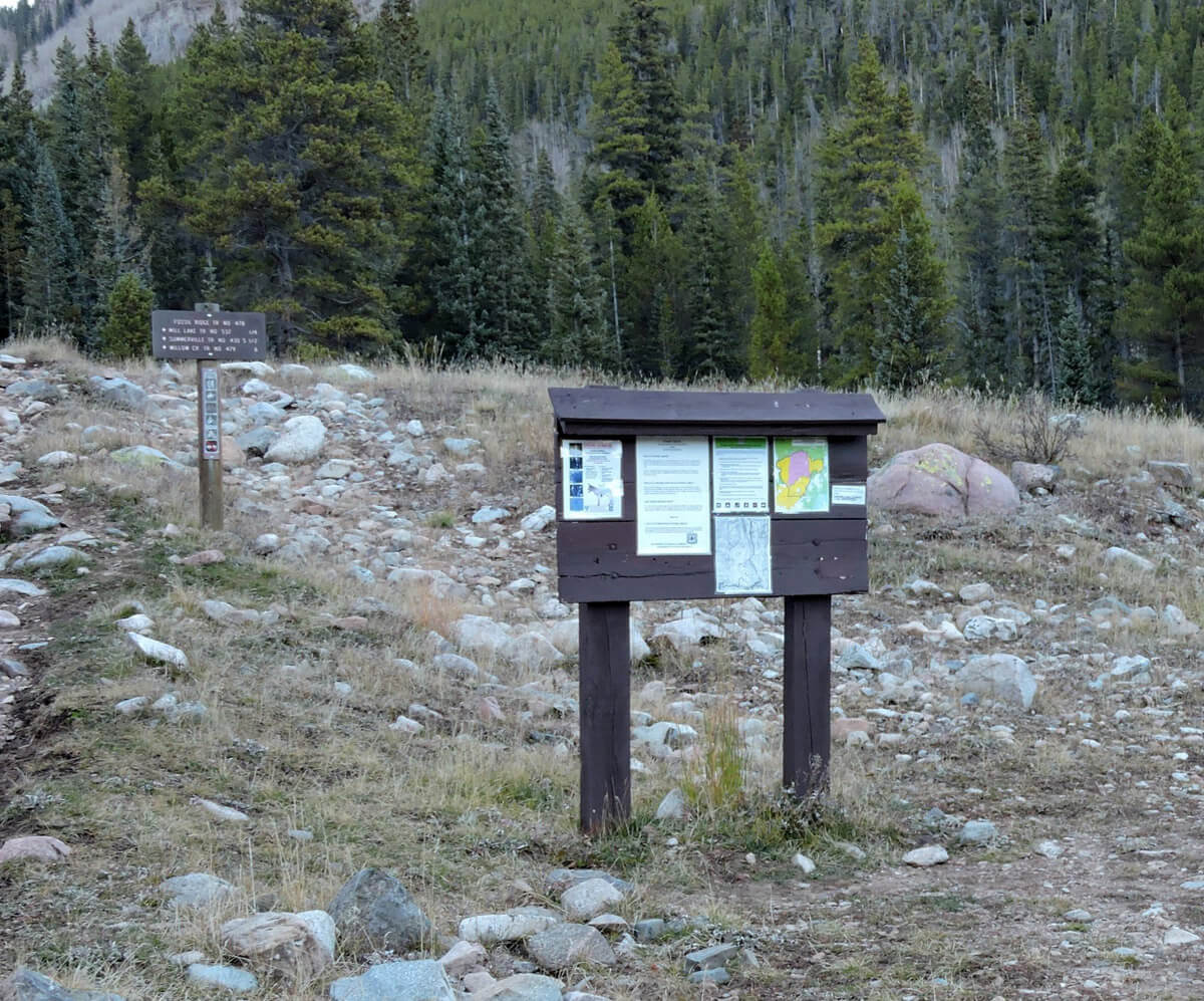
- Look for and find the trail head marker that stands alone just beyond the larger Forest Service wooden marker.
- Hike 1/4th mile above the marker and you will see a metal sign-in box beside the trail at 38.39.584N 106.34.718W. BEWARE! You may have just passed the turn for the Boulder Lake Hike on your way to the sign-in box! DO NOT continue directly ahead or you will be on the way to Mill Lake.
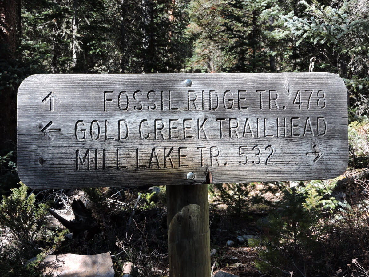
- The sign you will see at the start of the trail DOES NOT list Boulder Lake. Look at the top line on the rectangular wooden sign you see. The inscription will read “Fossil Ridge TR(ail) 478 with an arrow that points the proper direction to the trail for Boulder Lake.
- This is one of the most user-friendly trails I have hiked. There are less rocks and loose materials to navigate than usual. There are a few markers without signs later in the hike. Ignore them and continue on the main trail. The trail is very clearly defined all the way to the next SIGN POST that you will encounter.
- The SIGN POST is just beyond the outflow creek that originates at Boulder Lake. The live water crossing is your signal that the final turn to the lake is imminent.
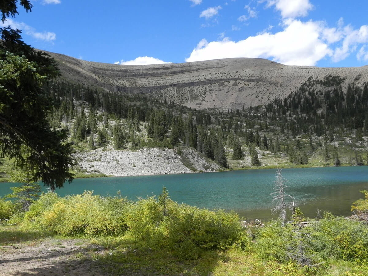
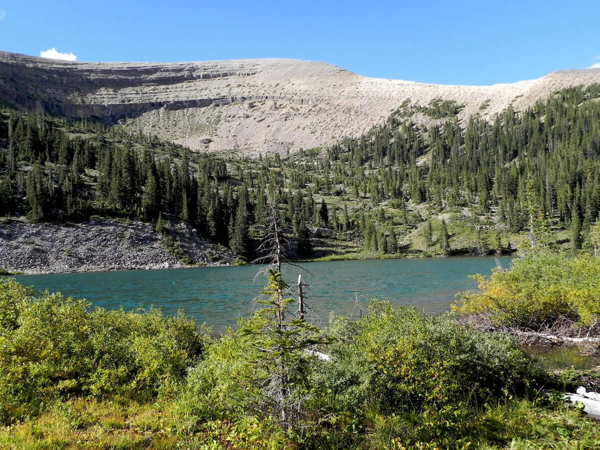
- That SIGN POST is where you turn right and follow the clearly defined 478 trail that will lead you to your destination—Boulder Lake. Be ready to see the stunning sight that will suddenly appear. You will be well rewarded for your hiking efforts!