Roosevelt Mine Hike
(text and photos by Glen Kirkendall)
 Depart Pitkin traveling west on Colorado 76. Mark your mileage when you are beside the Pitkin City Limits sign as you leave town. Travel exactly three (3) miles down the road and find the parking area on the left side of the road. Watch for mile marker #12. The parking area is immediately beyond that marker.
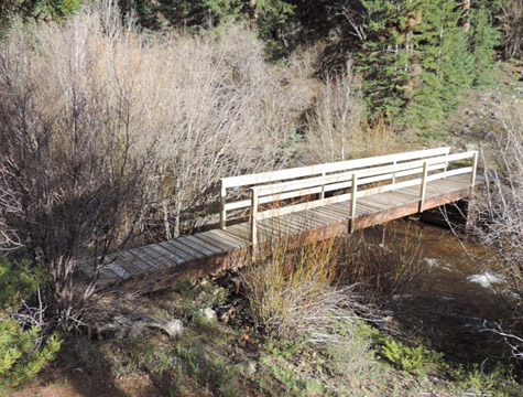
- Park your vehicle and find the trail that leads south toward Quartz Creek. Follow the trail, cross the sturdy bridge, and continue as it leads you to the left.
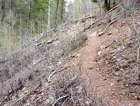
- Follow the path as you hike beside Quartz Creek. There is one area where walking across tightly implanted rock is required. The rock is black and its name is hornblende.
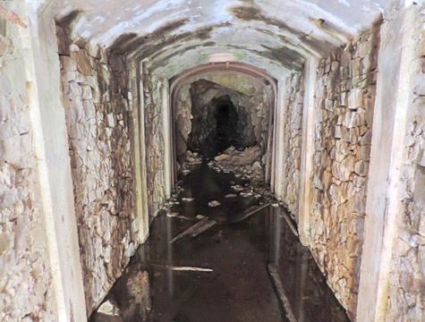
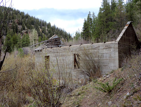
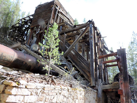
- Continue on the trail and reach the formed concrete Power Generation Plant that supplied electricity to the Roosevelt Mine. Water for operating the turbines came from Quartz Creek and was carried to the site by a large wooden flume that passed through the hammer mill and separation plant (the large building that can be seen from Colorado 76) before reaching the generating site. Most of the steel bands which held the flume together can be seen beside the trail above the concrete building.
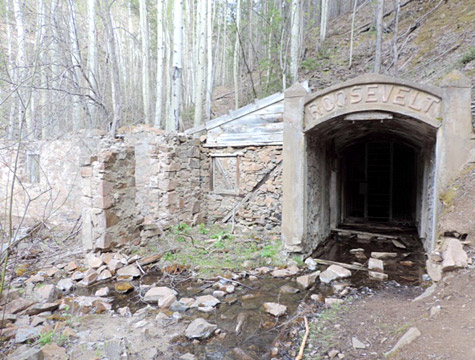
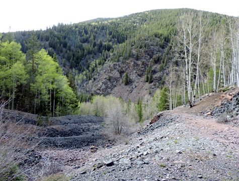
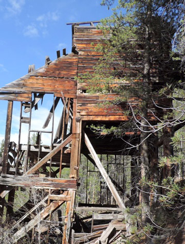
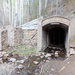
- Continue upward on the same main trail. DO NOT take the very steep incline to the graded road. The main trail is not as steep as that “shortcut trail.” The hiking will be best if you remain on the trail that is near the steel bands. You will need to cross behind the old flume bridge and upward to the right until you reach the graded mine trail. Turn to the right (this may seem backward but it is not). Follow the gentle grade upward. In this manner, you will reach the Roosevelt Mine Tunnel and the remaining walls of the old mine buildings. The distance from the parking area to the mine entrance is approximately .60 mile. The shaft has been barricaded for the sake of safety. Old mine shafts are unpredictable and may collapse without warning.
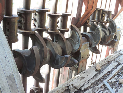
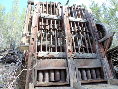
- If you like rocks, it is fun to hike down through the mine tailing mounds and see samples of the stone materials and minerals that were removed from the tunnel by the miners. There is a trail on the upper right side of the tailings that will also lead you down to the original building that contains the stamp and separating mill. Care is necessary around the old building, but you can see the stamping mechanism clearly. Note the large wooden wheel which was turned by a wide belt driven by water that supplied power for the rock crushing process. The large metal cylinder is the water flume.
- The old wooden water flume originated at what is now the Quartz Creek Cabins. Water entered the flume there and was carried on the contour all the way to the stamp and milling building as well as to the power generating plant. It must have been a difficult and time consuming process to build that long water line out of wood held together by steel bands by the thousands!
- Work your way from the stamp and separating building, cross the lower portion of the tailing mounds to the graded road, descend back to the old concrete building, and follow the trail to your vehicle. Be sure and take a camera! Study and consider what you see! Your trip will give you a feel for the mining experience of long ago.
- Hiking safely is not an accident. Stop when you wish to admire the scenery. Concentrate on the trail when you are moving.