Pitkin Loop Hike (text and photos by Glen Kirkendall)
This is a great hike that begins anywhere you are in the town of Pitkin. The nifty part is that the hike ends wherever you started! You will be pleasantly surprised by the beauty and variety you will see and experience. The distance is two miles from locations at or below the Silver Plume.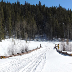
- Hike south (down) State Street and continue to the Waunita Passbridge that crosses over Quartz Creek.
- The road continues to the right but you should look for a fork that turns to the left. Choose the two wheel trail that moves uphill and to the left.
- The climb is a bit steep at first but don’t become discouraged. the terrain soon becomes friendlier.
- The trail turns to the right as it goes upward. Hike until you see where the Forest Service has closed the old road that forks to the left of the main ATV trail.
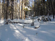
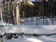
- Look for good size trees that have been dropped across the faint ATV trail to the left. Do NOT continue on distinct two wheel trail.
- Hike around the fallen trees, find the old ATV trail and follow it. *The GPS reading at this location is 38-36-078 N. —106.31.322 W. You will have traveled .45 mile from the bridge at this point.
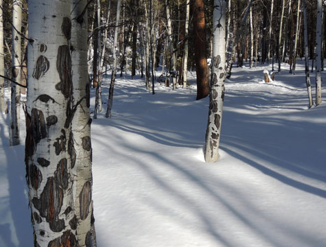
- Follow the trail that winds through the forest. Stop and enjoy the beauty of the forest. You may see deer, squirrels, birds, flowers, and mushrooms in season. The mushrooms in this area are usually not edible, so beware! You will hear sounds from the town of Pitkin and have glimpses of the buildings as you hike.
- Hike until you come to a well used road/trail. This trail is referred to as Powderhouse Road. It leads downward and will return you to the upper part of Pitkin on River Street.
NOTE: If you wish to shorten the trip by approximately one half you can park a vehicle in Pitkin (not in front of a residence) and drive to the Waunita bridge area in a second vehicle, find a parking place, and begin the hike. The choice is yours. This route would shorten the hike to “one mile,” more or less, depending on where the first vehicle is parked.